You want water, walkability, and a daily rhythm that feels both relaxed and alive. If Bayou St. John has caught your eye, you are not alone. This is one of New Orleans’ most beloved green corridors, where historic homes face lawns that roll down to a calm urban bayou and neighbors paddle past in the early light. In this guide, you will learn how life along the bayou works day to day, what kinds of homes you will find, and the practical checks to make before you buy. Let’s dive in.
What and where it is
Bayou St. John runs through Faubourg St. John and Mid‑City, shaping a long public greenway used more for recreation than commerce today. The banks offer grassy paths and bike and pedestrian corridors that many residents use daily. The corridor ties into regional trails and greenspace, including the Wisner path and the Lafitte Greenway, which connect the bayou to City Park and the French Quarter. For landscape context and trail links, see the Cultural Landscape Foundation’s overview of Bayou St. John’s public realm.
City Park sits along the western stretches of the bayou and acts like an extension of your backyard. The park’s amenities include boating, biking, and wide open lawns for picnics, fitness, and weekend routines. If you value quick transitions from porch to park, this adjacency is a defining perk of bayou living.
Daily life on the water
Walk, bike, and paddle
You can walk or cycle beside the water for morning exercise, then loop through City Park for shaded routes under live oaks. The Lafitte Greenway connection brings an easy bikeable link toward Downtown. Many residents plan errands and meetups around these trails because they are practical and scenic.
Getting on the water
The bayou is a calm, narrow corridor best enjoyed by kayak, canoe, or stand‑up paddleboard. Local outfitters operate at the Moss Street and Florida Avenue area, and the popular Bayou Paddlesports launch makes it simple to rent gear or join group paddles. Bridges are low and the waterway suits non‑motorized craft, so paddlers should watch water levels and event notices.
Community and culture
Bayou‑side stewardship is strong and visible, from monthly cleanups to big cultural moments. The best‑known event is the Mid‑City Bayou Boogaloo, a multi‑stage music and food festival along the banks. Like most major neighborhood events, it brings crowd energy and some temporary impacts that organizers and neighbors actively negotiate. In 2025, permit conditions and site plans were refined through a public process, a reminder that community dialogue shapes festival footprints. For quieter history programming, the Pitot House hosts tours and bayou‑focused walks led by the Louisiana Landmarks Society; see the Bayou St. John walking tour for dates.
The homes you will find
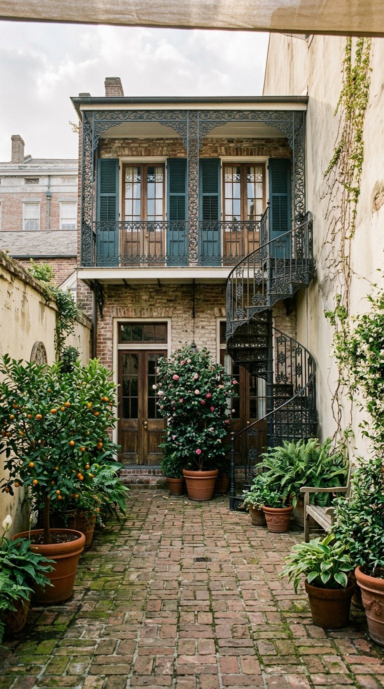
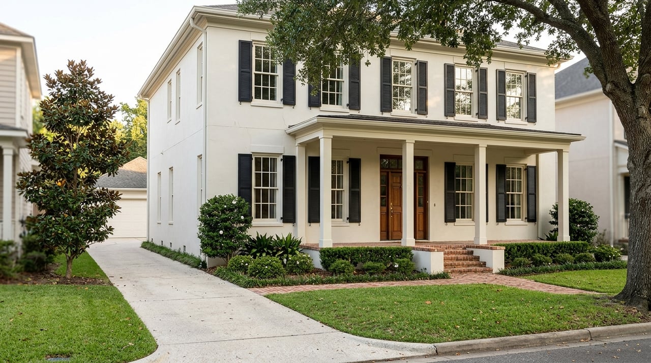
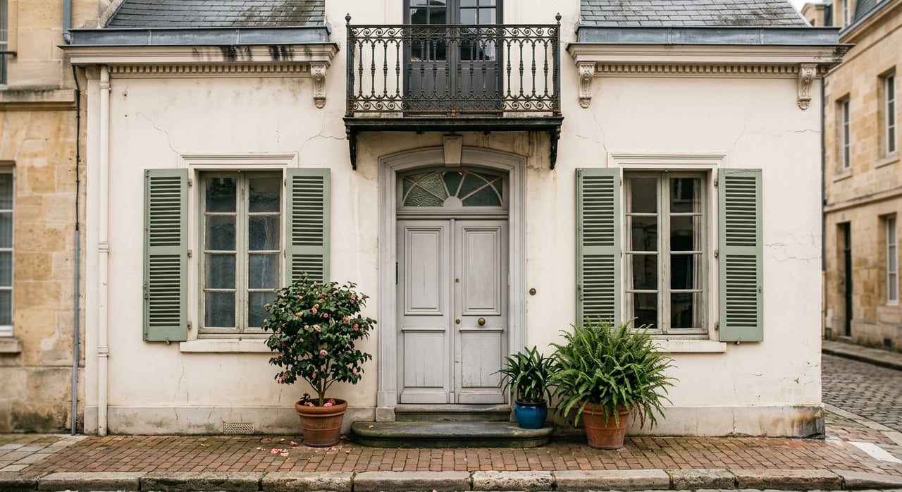
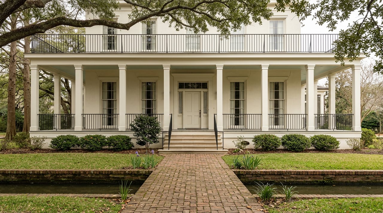
Along Bayou St. John and Esplanade Ridge, you will see a layered mix of Creole cottages, single and double shotguns, raised cottages, two‑story double‑gallery houses, and early‑20th‑century bungalows. This variety gives the corridor its architectural texture and charm. Many homes that face the water are older and often restored, with porches and small front yards that feel connected to the public green.
If you love architecture, this area reads like a living catalog of New Orleans housing types. For a quick primer on the forms and details you will encounter, browse the Preservation Resource Center’s overview of classic New Orleans house styles. Expect that standout examples and more ornate residences cluster along historic ridgelines and Esplanade.
Preservation and permits
Large portions of Faubourg St. John and Esplanade Ridge fall within local and national historic districts. If you plan any visible exterior changes, you will likely need review and a Certificate of Appropriateness from the Historic District Landmarks Commission. The city’s One‑Stop resources explain how HDLC approvals fit into the permitting process; start with this introductory guide.
The practical takeaway is simple. Build timeline room for design review and permits, especially for windows, façades, porches, or additions. Older homes reward you with character, but they ask for careful, code‑aware updates and a team that understands preservation.
Flood, drainage, and resilience basics
How protections work here
Two systems shape risk near the bayou. Regional storm surge risk is addressed by the U.S. Army Corps of Engineers’ Greater New Orleans system known as HSDRRS. You can learn more about that surge protection at the Corps’ HSDRRS overview.
Interior stormwater is different. New Orleans relies on pumps, canals, and drainage infrastructure to move rainfall out of the bowl. The Sewerage and Water Board outlines the network and ongoing projects on its stormwater resource page. Heavy rain can still cause street flooding, which is why site elevation and drainage details matter.
What to check for a property
Flood insurance and permitting are tied to official maps and surveys. The FEMA Flood Map Service Center is the authoritative place to check a property’s regulatory flood zone and base flood elevation. Lenders typically require flood insurance for homes in Special Flood Hazard Areas. Start your due diligence with the FEMA map viewer and ask the seller for any Elevation Certificate.
Beyond maps and certificates, ask about the home’s foundation history and whether any elevation or floodproofing work was permitted. Verify that prior flood repairs were done to code. If waterfront access is important, confirm whether the yard actually has direct access to the bayou and whether any ramp or dock has permits. Many bayou banks are public greenway, so private dock rights are not a given.
Buyer checklist for Bayou St. John homes
Use this quick list when you tour and compare properties:
- Check the address in FEMA’s Flood Map Service Center and request any Elevation Certificate, LOMA, or LOMR documentation.
- Ask whether the home has had foundation or elevation work, whether permits were pulled, and whether there is a current elevation survey or as‑built certification. The SWBNO stormwater page can help you understand local drainage context.
- If the home is in a historic district, plan for HDLC review of visible exterior changes and read the city’s intro to approvals and permits.
- If waterfront access is a priority, confirm in writing whether there is true water access or any permitted ramp or dock. Many stretches of bank are public greenway.
- For lifestyle, map your daily routes. City Park’s amenities and trail connections along the bayou make walking, biking, and paddling part of everyday life.
Life along a public greenway
Living on this corridor means sharing a beautiful front yard with the city. You will see joggers, cyclists, families with strollers, and paddlers moving past on clear days. Seasonal events may bring crowds and temporary parking limits, especially during the Bayou Boogaloo. This blend of peaceful weekdays and lively weekends is part of the bayou’s appeal.
Is Bayou St. John right for you?
Choose Bayou St. John if you want architecture, access, and a strong sense of place. You will trade some modern conveniences for historic character, and you will plan projects with preservation and flood rules in mind. In return, you get a daily relationship with the water, a park at your doorstep, and a neighborhood that feels both intimate and connected to the best of the city.
If you are ready to explore curated listings or want discreet guidance on a private purchase, connect with the team at New Orleans Luxury Living. We help you evaluate design, permits, and risk with confidence, then position you to buy the right home along the bayou.
FAQs
What is Bayou St. John and where is it?
- It is an urban waterway and green corridor in Mid‑City and Faubourg St. John with trails that link to City Park and the Lafitte Greenway toward the French Quarter; see the Cultural Landscape Foundation’s overview for context.
Can you kayak on Bayou St. John and how do you launch?
- Yes, the bayou suits non‑motorized craft, with a popular launch area along Moss Street near Florida Avenue and rentals through Bayou Paddlesports.
Are private docks common for bayou homes?
- No, many banks are public greenway; confirm any private water access, ramp, or dock rights and permits during due diligence since private docks are not guaranteed.
How does flood protection work near the bayou?
- Regional surge risk is reduced by the Corps’ HSDRRS system, while rainfall drainage relies on pumps and canals managed by the Sewerage and Water Board.
How do I check a home’s flood zone and insurance needs?
- Search the specific address in FEMA’s Flood Map Service Center and request the property’s Elevation Certificate to understand insurance and compliance requirements.
What permits are needed for exterior work on a historic home here?
- Many properties fall under HDLC jurisdiction and need a Certificate of Appropriateness for visible exterior changes; start with the city’s intro to approvals and permits and plan your timeline accordingly.
What major events should I expect along the bayou?
- The Mid‑City Bayou Boogaloo is the signature festival, and recent permit discussions show how organizers and neighbors coordinate to manage impacts like parking and fencing.